Showing posts with label 146. Show all posts

UCR/BOAT: Pisley Lane

Location: Pisley Ln, Dorking, Surrey RH5, UK
  • Overall Rating: 5
  • Location: Walliswood, Surrey.
  • OS Explorer Map 134, 'Crawley & Horsham'.
  • Starting OS Grid Reference: TQ137401
  • Starting GPS Co-ordinates: N51 14' 90" W000 37' 60"
  • Finishing OS Grid Reference: TQ122393
  • Finishing GPS Co-ordinates: N51 14' 20" W000 39' 80"
  • To see: not much.
  • ALWAYS follow the Greenlane Code!
Holden Brook Ford
Annoyingly, this byway starts on a completely different OS map, namely OS Explorer 146 'Dorking, Box Hill & Reigate'. It starts as a concreted UCR leaving Mole Street to the west, serving as the driveway for a couple of cottages as well as Holdenbrook, Pisley and Fishfold Farms. Back on OS Explorer 134 The greenlane winds its way through some pleasant woodland called (funnily enough) Pisley Copse and then is re-designated as a BOAT on passing Fishfold Farm, although it continues to be concreted.

As the driveway to Holdenbrook Farm divereges to the north west, the lane itself turns to the left and the concrete turns into leaf mould and mud. This trail is in good condition: the majority of the vegetation has been cut back and for the most part the surface is unrutted and easy going, even in very wet weather.

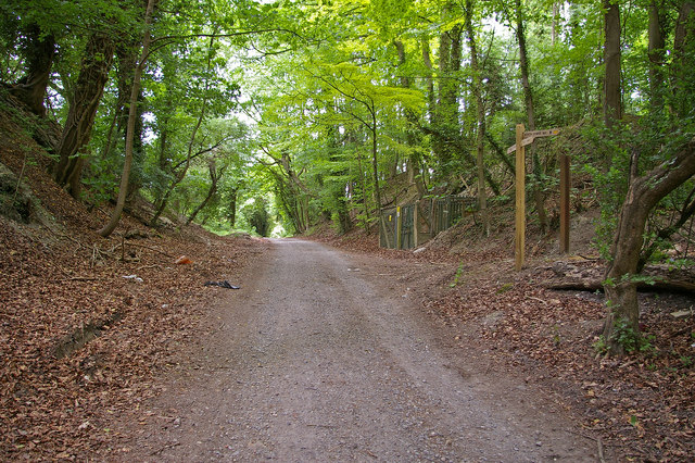
The junction between Pisley Lane and Green Lane.
Speaking of water, and why this lane scores so highly, is that from Holdenbrook Farm the lane begins a slow descent downhill until it meets Holden Brook where it fords this extremely pleasant stream. A footbridge crosses the river on the southern side of the ford and on a summer's day this would be a great place for a picnic and a paddle. However, for the purposes of greenlaning, the ford is usually pretty shallow (although the trail biker in the video embeded below obviously picked the wrong day to try to ford it! Let that serve as a warning to all.) and has a bottom of fine gravel that seems to be more than capable of supporting a 4x4, and we got through it with no trouble. Needless to say, it is highly advisable for you to check the depth of the water and condition of it's surface before you go piling in, and if you get stuck it's not our fault!

Climbing out onto the far bank, the lane turns slightly to the west and then takes a more or less straight track until the byway finishes on Horsham Road. A far better option to continue greenlaning is to take the turning to the south (at TQ124394, see picture above) down another, similar, BOAT called Green Lane.

One final note: Pisley Lane carries on for a very short distance as a UCR over the other side of Horsham Road, but since it's a dead end it is entirely pointless driving it.

This is Surrey County Council's Abinger Byway 542.


View Pisley Lane in a larger map

BOAT: Beggars Lane

Location: Beggars Ln, London, Surrey, UK
  • Overall Rating: 0
  • Location: Abinger Hammer, Surrey.
  • OS Explorer Map 146, 'Dorking, Box Hill & Reigate, Leatherhead & Caterham.'
  • Starting OS Grid Reference: TQ092447
  • Starting GPS Co-ordinates: N51 21' 80" W000 43' 80"
  • Finishing OS Grid Reference: TQ111496
  • Finishing GPS Co-ordinates: N51 23' 50" W000 41' 10"
  • To see: Lovelace Bridges, Ranmore Common, Effingham Forest.
  • ALWAYS follow the Greenlane Code!
Beggars Lane is unfortunately closed to 4x4 traffic, but somewhat unfairly it is open to trail bikers and other motorised traffic. Lame. Instead, go drive Sheepwalk Lane which passes the northern end of this byway.

No dice.

View Beggars Lane in a larger map

BOAT: Sheepwalk Lane

Location: Sheepwalk Ln, London, Surrey, UK
  • Overall Rating: 5
  • Location: East Horsley, Surrey.
  • OS Explorer Map 146, 'Dorking, Box Hill & Reigate, Leatherhead & Caterham.'
  • Starting OS Grid Reference: TQ095502
  • Starting GPS Co-ordinates: N51 24' 10" W000 43' 30"
  • Finishing OS Grid Reference: TQ120500
  • Finishing GPS Co-ordinates: N51 23' 80" W000 39' 70"
  • To see: Lovelace Bridges, Ranmore Common, Effingham Forest.
  • ALWAYS follow the Greenlane Code!
Troy Bridge
Sheepwalk Lane is a byway brought to you by bridges. Well, not bridges as such any longer as they serve no discernible purpose these days. However, built by the Earl of Lovelace in the 19th century, these so called Lovelace Bridges (which total  fifteen  in all) were built to ease the passage of the horse-drawn carts hauling felled timber on his woodland estate, but the old chap went rather overboard and gave them such architectural embellishments as his trademark flintwork, arrow slits and date-plaques! There is a walking trail right around all fifteen of them, which is detail here.

On to the byway itself, and annoyingly it is split over two maps. The far western tip (where we began) is on OS Explorer Map 145 'Guildford & Farnham', and is accessed by driving down a country road called Honeysuckle Bottom. Look out for the cottage with its very own railway in the garden (I kid you not!) on the right hand side. The path to take is pretty obvious: right at the end of the (barely) metalled section of Honeysuckle Bottom, where all the freshly felled timber is stacked up, Sheepwalk Lane heads east and uphill through pleasant Effingham Forest on a surface of mixed gravel and mud. It's very easy going even in the wettest conditions: almost entirely unrutted, well cut back and you could drive a tank under both bridges.

Troy Bridge is the first one encountered (see above). Pass under it and the lane curves gently around to the left, climbing ever slowly up. Further along a second (unnamed, as far as I know) bridge is encountered abeam a house called The Hermitage.

Eventually the summit of this lane is reached atop White Downs, where another byway called Beggars Lane merges with ours. It is sadly closed to 4x4's (but, perhaps unfairly, open to trail bikers) and is gated off accordingly. Instead, bear round to the left and head eastwards.

The lane is soon crossed by a country lane called White Down Lane, and on each side of the crossing nasty looking gates have been erected to discourage fly-tipping scum. The width restriction is precisely 7', and not an inch more. However, that is just enough to squeeze a Defender 110' through with great care, as the council have also embedded stone kerbs in the surface to further complicate matters. They really rock the suspension if hit wrong which in turn can rock you car sideways into the posts, so use a spotter if you're not confident.

After crossing the lane, Sheepwalk Lane climbs steeply uphill for a stretch before jinking to the left slightly and finishing (via another 7' barrier) on Ranmore Common Road, just west of the car park for the common itself. A brilliant sylvanian lane, one of the best in the area, and so it's well worth a visit.


View Sheepwalk Lane in a larger map

BOAT: Chalkpit Lane

Location: 2 Chalk Pit Ln, Great Bookham, Surrey KT23, UK
  • Overall Rating: 3
  • Location: Effingham, Surrey.
  • OS Explorer Map 146, 'Dorking, Box Hill & Reigate, Leatherhead & Caterham.'
  • Starting OS Grid Reference: TQ131525
  • Starting GPS Co-ordinates: N51 26' 00" W000 38' 00"
  • Finishing OS Grid Reference: TQ128536
  • Finishing GPS Co-ordinates: N51 27' 00" W000 38' 40"
  • To see: Polesden Lacey, Ranmore Common.
  • ALWAYS follow the Greenlane Code!
Chalkpit Lane (we never saw any evidence of the pit it takes its name from...) drives southwards from the A246 west of Leatherhead in the village of Effingham. It's pretty unremarkable when considered on its own, but when considered along with Hogden Lane it is most certainly worth a look, and scores higher because of it.

The lane offers a decent enough drive on a short stretch of concrete which quickly changes to a well tended gravel surface, and is bordered on its eastern side by a low hedgerow and on its west by a narrow strip of woodland, both of which have been recently cut back (apparently by Esso, or so says the random sign) so that they do not impede access at all (i.e. the paintwork is safe!).

At its southern end it merges with Hogden Lane, and this article is designed to be read in conjunction with that one, so please click through to it. 

Note the rubbish bag hung on the Byway sign. This should not even need to be said, but that bag should not exist. The fact it does is an embarrassment and not a good advert for the human race. Those who litter should have their hands cut off! DON'T DO IT! Full marks to the decent folk who tidied up and put it there for the use of others. (Sorry for the rant, but I despise litter. It really gets to me! As you can see.)

The junction with Hogden Lane.

View Chalkpit Lane in a larger map

BOAT: Pitchfont Lane

Location: Pitchfont Ln, London, Surrey, UK
  • Overall Rating: 0
  • Location: Limpsfield, Surrey.
  • OS Explorer Map 146, 'Dorking, Box Hill & Reigate, Leatherhead & Caterham.'
  • Starting OS Grid Reference: TQ398555
  • Starting GPS Co-ordinates: N51 28' 10" E000 00' 40"
  • Finishing OS Grid Reference: TQ406538
  • Finishing GPS Co-ordinates: N51 26' 60" E000 01' 30"
  • To see: Titsey Place and Gardens.
  • ALWAYS follow the Greenlane Code!
This byway used to be a BOAT before the M25 severed it. It is now gated off and serves as the access road to the car park of Titsey Place and Gardens. Pointless to drive it unless you mean to visit the house.


View Pitchfont Lane in a larger map

BOAT: East Hill Lane

Location: E Hill Ln, Copthorne, Surrey RH10, UK
  • Overall Rating: 0
  • Location: Copthorne, West Sussex.
  • OS Explorer Map 146, 'Dorking, Box Hill & Reigate, Leatherhead & Caterham.'
  • Starting OS Grid Reference: TQ327407
  • Starting GPS Co-ordinates: N51 14' 30" W000 11' 30"
  • Finishing OS Grid Reference: TQ328398
  • Finishing GPS Co-ordinates: N51 14' 30" W000 10' 20"
  • To see: nothing much.
  • ALWAYS follow the Greenlane Code!
This byway is blocked by a metal gate at its halfway point, so it's a dead end. So is the UCR called Clay Hall Lane, which crosses this greenlane at its southern end. Pointless visiting it.


View East Hill Lane in a larger map

BOAT: Railpit Lane

Location: 2 Blackman's Ln, Warlingham, Surrey CR6, UK
  • Overall Rating: 1
  • Location: Fickleshole, Surrey.
  • OS Explorer Map 146, 'Dorking, Box Hill, & Reigate'.
  • Starting OS Grid Reference: TQ392596
  • Starting GPS Co-ordinates: N51 31' 90" W000 00' 40"
  • Finishing OS Grid Reference:  TQ394604
  • Finishing GPS Co-ordinates: N51 32' 50" W000 00' 10"
  • To see: not much.
  • ALWAYS follow the Greenlane Code!
Unfortunately this lane is too far gone and overgrown to seriously consider driving a 4x4 down, and damage would be inevitable, though a trail biker could possibly get through, with difficulty. As such, it's best to avoid this byway unless something drastically changes.


View Railpit Lane in a larger map

BOAT: Birchen Shaw

Location: Ledgers Rd, Warlingham, Surrey CR6, UK
  • Overall Rating: 0
  • Location: Limpsfield, Surrey.
  • OS Explorer Map 146, 'Dorking, Box Hill, & Reigate'.
  • Starting OS Grid Reference: TQ399544
  • Starting GPS Co-ordinates: N51 30' 60" W000 02' 30"
  • Finishing OS Grid Reference: TQ381575
  • Finishing GPS Co-ordinates: N51 30' 00" W000 02' 00"
  • To see: not much.
  • ALWAYS follow the Greenlane Code!
TRO: closed to vehicles.


View Birchen Shaw in a larger map

BOAT: Quarry Road

Location: Quarry Rd, Godstone, Surrey RH9, UK
  • Overall Rating: 1
  • Location: Godstone, Surrey.
  • OS Explorer Map 146, 'Dorking, Box Hill, & Reigate'.
  • Starting OS Grid Reference: TQ350541
  • Starting GPS Co-ordinates: N51 27' 00" W000 06' 70"
  • Finishing OS Grid Reference:  TQ351531
  • Finishing GPS Co-ordinates: N51 26' 10" W000 06' 50"
  • To see:  course of Roman Road, Pilgrim Fort, Quarry Hill Vineyard.
  • ALWAYS follow the Greenlane Code!
There really is nothing remarkable about this short stretch of byway that runs alongside the A22 for a total of 900m or so, other than it was a Roman Road which ran from London to Portslade, which then became a turnpike road before the dual-carriageway A22 came along. It's now been relegated to the access road for Paddock Farm, Quarry Farm and a fishery. Not really worth the bother.

A Napoleonic hill fort called  Pilgrim Fort, similar to those on Box Hill and above Reigate, can be found over the A22, and for those interested in viticulture Quarry Hill Vineyard lies just to the east of the greenlane.


View Quarry Lane in a larger map

UCR: Stubpond Lane

Location: Stubpond Ln, Felbridge, Lingfield, Surrey RH7, UK
  • Overall Rating: 2
  • Location: Felbridge, Surrey.
  • OS Explorer Map 146, 'Dorking, Box Hill, & Reigate'.
  • Starting OS Grid Reference: TQ358407
  • Starting GPS Co-ordinates: N51 14' 90" W000 06' 00"
  • Finishing OS Grid Reference:  TQ354417
  • Finishing GPS Co-ordinates: N51 15' 90" W000 06' 60"
  • To see:  Hedgecourt Lake, Roman road.
  • ALWAYS follow the Greenlane Code!
Hedgecourt Lake
We chose to drive this lane from the southern end, starting from Mill Lane. After passing the beautiful Hedgecourt Lake on the left hand side, which is a great picnic and angling spot, the tarmac surface of Mill Lane gives way to the rubble and earth surface of the UCR just after passing a house Hedgecourt on the left hand side. The lane is well kept with regards to encroaching undergrowth, and short of the odd pothole it presents no challenge at all. Climbing up a slight incline over the course of the lane, the byway is pretty unremarkable in every sense. It passes through the yard of Churchill Farm and then Stubpond Fishery, and ends on the B2028 just west of the A22. It's not really worth driving other than for the awesome view over Hedgecourt Lane, and hence only scores a 2.

The course of a Roman road which ran from London to Lewes lies just to the east of Mill Lane, and just south of the A264 a small section can still be seen.


View Stubpond Lane in a larger map

BOAT: Pudding Lane/UCR:Chapel Road

Location: Pudding Lane, Charlwood, Surrey RH6, UK
For the sake of convenience, these two technically separate lanes are included as one post, as it is not possible to drive one without the other.

Starting at the western extremity, then, Pudding Lane (the BOAT portion) leaves Norwoodhill Road in the village of Charlwood almost due east. The unkempt tarmac surface of a driveway at this stage, once passing the gates to Spottles Farm the lane reverts to a seriously rutted earthern surface. The ruts are very deep in a couple of spots and a Freelander could well ground out. On reaching a dilapidated gate, however, the ruts (strangely) end completely and the lane look very well kept indeed, probably due to the rubble that has been mixed into the earthen surface of the lane.

The lane continues in this manner until turning through over 90 degrees to the south in order to follow the course of Chapel Road. With no prizes for guessing how this lane got its name, on passing Providence Chapel the lane changes to a UCR, becomes metalled, and continues through a housing estate to finish just round the corner from where it started in Charlwood village.

For those with an interest in history, the 16th century moated manor house Charlwood Place lies just to the north of Pudding Lane (not open to the public). Lowfield Heath windmill (open once a month) can be found just to the west of Charlwood. Providence Chapel lies at the top of the UCR section, and (occasionally open for mass) was originally a garrison for Napoleonic era troops which was subsequently moved to Charlwood village in 1819. For those interested in plane-spotting, London Gatwick Airport lies very nearby to the south-east.

Providence Chapel

View Pudding Lane in a larger map

BOAT: Wilmot's Lane

Location: Gayhouse Ln, Redhill, Surrey RH1, UK
  • Overall Rating: 3
  • Location: Outwood, Surrey.
  • OS Explorer Map 146, 'Dorking, Box Hill, & Reigate'.
  • Starting OS Grid Reference: TQ329454
  • Starting GPS Co-ordinates: N51 19' 20" W000 10' 00"
  • Finishing OS Grid Reference:  TQ329446
  • Finishing GPS Co-ordinates: N51 18' 50" W000 09' 90"
  • To see: the windmill in Outwood, Outwood Common.
  • ALWAYS follow the Greenlane Code!
Starting at it's northern end on leaving (the amusingly titled) Gayhouse Lane, this byway starts life as a tarmac driveway to a barn, but quickly changes to an earthen surface and plunges into woodland. It is a somewhat narrow lane, but never dramatically so, due to the drainage ditch that runs alongside the lane on its eastern side and the occasional mature tree on the western side.

Unrutted and easy going (even more so since I cleared a fallen tree, with much gusto and chivalry, at around the mid point of the lane!) there is nothing to present a challenge or danger whilst driving it. After winding its way through the trees and proceeding gently downhill, the lane ends back on the tarmac where a footpath crosses the lane at Wilmot's Farm. A pleasant if brief drive.

Supposedly Britain's oldest working windmill (aren't they all?!), never-the-less Outwood Mill is certainly worth a look (prior permission required) and National Trust-owned Outwood Common is a great place for a walk or a picnic on a glorious summer's day.


View Wilmot's Lane in a larger map

BOAT: Langshott

  • Overall Rating: 1
  • Location: Horley, Surrey.
  • OS Explorer Map 146, 'Dorking, Box Hill, & Reigate'.
  • Starting OS Grid Reference: TQ292441
  • Starting GPS Co-ordinates: N51 18' 10" W000 15' 30"
  • Finishing OS Grid Reference:  TQ298437
  • Finishing GPS Co-ordinates: N51 17' 80" W000 14' 40"
  • To see: not much.
  • ALWAYS follow the Greenlane Code!
This dead-end byway, which changes status to a bridleway just after its halfway point, is nothing more than the metalled access road to some private houses and therefore offers nothing of interest to the greenlaner.


View Langshott in a larger map

BOAT: Fort Lane

Location: Fort Ln, Reigate, Surrey RH2, UK
  • Overall Rating: 1
  • Location: Reigate, Surrey.
  • OS Explorer Map 146, 'Dorking, Box Hill, & Reigate'.
  • Starting OS Grid Reference: TQ258524
  • Starting GPS Co-ordinates: N51 25' 70" W000 19' 80"
  • Finishing OS Grid Reference:  TQ259522
  • Finishing GPS Co-ordinates: N51 25' 50" W000 19' 70"
  • To see: Reigate Fort.
  • ALWAYS follow the Greenlane Code!
This short byway is nothing more than the metalled access road to a farm and Reigate Fort, and has no interest to the greenlaner. However, for the historian, a visit to the fort is well worth the investment of your time!


View Fort Lane in a larger map

BOAT: Courtoak Lane

Location: Courtoak Ln, Redhill, Surrey RH1, UK
  • Overall Rating: 0
  • Location: Outwood, Surrey.
  • OS Explorer Map 146, 'Dorking, Box Hill, & Reigate'.
  • Starting OS Grid Reference: TQ319444 
  • Starting GPS Co-ordinates: N51 18' 40" W000 11' 40"
  • Finishing OS Grid Reference:  TQ323445
  • Finishing GPS Co-ordinates: N51 18' 40" W000 10' 90"
  • To see: not much.
  • ALWAYS follow the Greenlane Code!
This short byway is unfortunately subject to a TRO and closed to traffic.


View Courtoak Lane in a larger map

BOAT: Hatch Lane

Location: Hatch Ln, Redhill, Surrey RH1, UK
  • Overall Rating: 0
  • Location: Nutfield, Surrey.
  • OS Explorer Map 146, 'Dorking, Box Hill, & Reigate'.
  • Starting OS Grid Reference: TQ308461 
  • Starting GPS Co-ordinates: N51 19' 90" W000 12' 90"
  • Finishing OS Grid Reference:  TQ309472
  • Finishing GPS Co-ordinates: N51 20' 90" W000 12' 70"
  • To see: not much.
  • ALWAYS follow the Greenlane Code!
This byway, which follows the line of the M23, is unfortunately subject to a TRO and closed to traffic.


View Hatch Lane in a larger map

BOAT: Moats Lane

Location: Moats Ln, Redhill, Surrey RH1, UK
  • Overall Rating: 0
  • Location: Nutfield, Surrey.
  • OS Explorer Map 146, 'Dorking, Box Hill, & Reigate'.
  • Starting OS Grid Reference: TQ303466 
  • Starting GPS Co-ordinates: N51 20' 30" W000 13' 60"
  • Finishing OS Grid Reference:  TQ306472
  • Finishing GPS Co-ordinates: N51 20' 90" W000 13' 20"
  • To see: not much.
  • ALWAYS follow the Greenlane Code!
Unfortunately subject to a TRO and closed to traffic.

The southern end. Clearly closed.

View Moats Lane in a larger map

BOAT: Beggarhouse Lane

Location: Beggarshouse Ln, Horley, Surrey RH6, UK
  • Overall Rating: 0
  • Location: Cudworth, Surrey.
  • OS Explorer Map 146, 'Dorking, Box Hill, & Reigate'.
  • Starting OS Grid Reference: TQ220417 
  • Starting GPS Co-ordinates: N51 16' 20" W000 25' 60"
  • Finishing OS Grid Reference:  TQ231419
  • Finishing GPS Co-ordinates: N51 16' 30" W000 24' 10"
  • To see: not much.
  • ALWAYS follow the Greenlane Code!
Unfortunately subject to a TRO and closed to traffic.


View Beggarhouse Lane in a larger map

BOAT: Green Lane

Location: Green Ln, Reigate, Surrey RH2, UK
  • Overall Rating: 2
  • Location: Shellwood Cross, Surrey.
  • OS Explorer Map 146, 'Dorking, Box Hill, & Reigate'.
  • Starting OS Grid Reference: TQ210549 
  • Starting GPS Co-ordinates: N51 19' 90" W000 27' 00"
  • Finishing OS Grid Reference:  TQ213458
  • Finishing GPS Co-ordinates: N51 19' 90" W000 26' 50"
  • To see: not much.
  • ALWAYS follow the Greenlane Code!
This very short byway is not really worth a drive: there are far better greenlanes to occupy yourself with before coming here! Starting out east from Shellwood Road, the lane is a nice wide track complete with a surface of gravel and dirt that never becomes rutted. The hedgerows that line the lane never encroach and threaten the paintwork either. It's pretty easy going, even for a Freelander.

Passing through fields to the north and Tweed Copse to the south, the lane ends as abruptly as it began, on tarmac in a housing estate, just after a bridleway leaves to the south. There's not much else to say!


View Green Lane in a larger map

BOAT: Tweed Lane

Location: Tweed Ln, Strood Green, Betchworth, Surrey RH3 7JA, UK
  • Overall Rating: 3
  • Location: Strood Green, Surrey.
  • OS Explorer Map 146, 'Dorking, Box Hill, & Reigate'.
  • Starting OS Grid Reference: TQ194487 
  • Starting GPS Co-ordinates: N51 22' 00" W000 29' 10"
  • Finishing OS Grid Reference:  TQ201480
  • Finishing GPS Co-ordinates: N51 21' 90" W000 28' 20"
  • To see: not much.
  • ALWAYS follow the Greenlane Code!
This short byway is never-the-less worth a quick drive, despite its brevity. Starting out east from Bushbury Lane, the greenlane is a nice wide track complete with large pieces of farm machinery dotted around. On a surface of mud that becomes progressively more rutted the further towards the western end you get, it's pretty easy going too, even for a Freelander.

Passing through fields to the north and Tweed Copse to the south, the lane ends as abruptly as it began, on tarmac in a housing estate, just after a bridleway leaves to the south. There's not much else to say!


View Tweed Lane in a larger map