- Overall Rating: 4
- Location: Shere, Surrey.
- OS Explorer Map 145, 'Guildford & Farnham, Godalming & Farnborough'.
- Starting OS Grid Reference: TQ074479
- Starting GPS Co-ordinates: N51 13' 15.25" W000 27' 53.69"
- Finishing OS Grid Reference: TQ078496
- Finishing GPS Co-ordinates: N51 14' 08.33" W000 27' 31.31"
- To see: the village of Shere, Silent Pool, Type 22 pillbox.
- ALWAYS follow the Greenlane Code!
PLEASE NOTE: This lane is subject to a TRO between 30th September to 1st May every year. As such, this lane is gated off. Do not attempt to drive this lane between these dates. For more info, please see here.
We drove this lane from it's southern end in Shere. This BOAT passes through the beautiful forested expanses of Netley Park, and from south to north it climbs steadily up to around 195m above sea level.
 Starting in Shere by the recreation ground, the lane immediately plunges into the forest on a very lightly rutted compacted chalk surface. We drove this lane in the pouring rain in August, and this meant that the chalk surface was pretty slippery. It certainly made moving a sizeable fallen branch a far harder (and dirtier) task than it needed to be (see picture, bottom!), but anyone with road-biased tyres would probably have quite a bit of trouble on the steeper sections when it's this wet. The undergrowth is at it's tightest at the southern end, but it is by no means a problem.
 The lane heads almost due north up a gentle incline, and passes through a concrete bridge (pictured above left) which carries the A25. There is obviously limited headroom, but unless you have an insane suspension lift and vast tyres it shouldn't be a problem. Just after the bridge the lane rises steeply and turns to the north east. This is its tough spot, as outlined above, and in the pouring rain it proved a little tricky. In the dry, however, it really wouldn't pose a challenge.
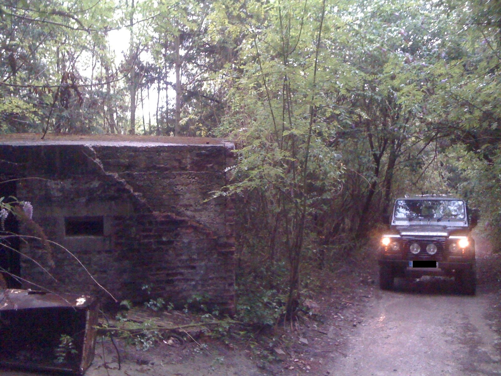
 Once round the corner the lane continues uphill, bears to the left, and soon passes a Type 22 pillbox (pictured right) on the right. It's not been bricked up and is in relatively good condition, so if you are interested in such things it's certainly worth stopping briefly to investigate. After the pillbox the lane for the most part levels off, and after around 500m turns 90 degrees to the west, enters a small car park and finishes where it meets Combe Lane. There is a height restriction barrier at the lane's northern end (pictured left) put in place to discourage fly tippers (there were numerous fridge/freezers in the car park, left by brain-dead heathen scum) but unusually the council have decently left an gap to the right of it, restricted by some quite impressive speed-bump type objects, for 4x4 access. Other barriers block access to the North Downs way and other footpaths in the area, so it is literally impossible to take a wrong turn.
It's certainly worth taking the detour at the southern end of the lane to see Silent Pool, a beautiful lake which inspired Tennyson, and to stop in the picturesque village of Shere.
We drove this lane from it's southern end in Shere. This BOAT passes through the beautiful forested expanses of Netley Park, and from south to north it climbs steadily up to around 195m above sea level.


It's certainly worth taking the detour at the southern end of the lane to see Silent Pool, a beautiful lake which inspired Tennyson, and to stop in the picturesque village of Shere.
View London Lane in a larger map
No comments:
Post a Comment
Please keep it clean!
Note: only a member of this blog may post a comment.