- Overall Rating: 5
- Location: Coldharbour, Surrey.
- OS Explorer Map 146, 'Dorking, Box Hill & Reigate, Leatherhead & Caterham.'
- Starting OS Grid Reference: TQ130473
- Starting GPS Co-ordinates: N51 12' 52.24" W000 23' 01.74"
- Finishing OS Grid Reference: TQ150440
- Finishing GPS Co-ordinates: N51 11' 03.94" W000 21' 15.39"
- To see: Anstiebury Camp, Leith Hill Tower, Tankards Pond, The Plough Inn.
- ALWAYS follow the Greenlane Code!
UPDATE 29/04/2016: According to another anonymous tip off, this byway has now been received the repairs it so badly needed and, incredibly, there is no evidence of a TRO! Open for business.
UPDATE 22/04/2016: The inevitable has happened and, after an inspection by their Rights-of-Way department, Surrey County Council have applied an emergency closure order to this byway. We shall see if it will ever open again!
UPDATE 25/03/2016: An anonymous poster (see below) states that a 'severe washout is developing at the northern end. The sand has subsided and [it] now means you have to tip-toe around the edge [of the washout]. The rate at which its becoming a severe obstacle (with guaranteed body damage) is very quick, over the course of less than week it has tripled in size.' You have been warned, and we would recommend avoiding this byway unless you have a capable vehicle. We sincerely hope that some remedial work is scheduled for this byway, but even so one could expect a TRO to be placed upon it if this continues.
 This is one of the longest byways that we've come across in our extensive travels of the southern counties, and also one of the best. Incidentally, this is also the only lane where we have ever met another offroader! As we rounded a bend we nearly claimed an unfortunate Suzuki Vitara. A rare occurrence indeed! Or is it? We visited on a week day and this was the only soul we encountered, but apparently, judging by the comment below, this byway is very popular indeed with cyclists so take it slow and give way when able to.
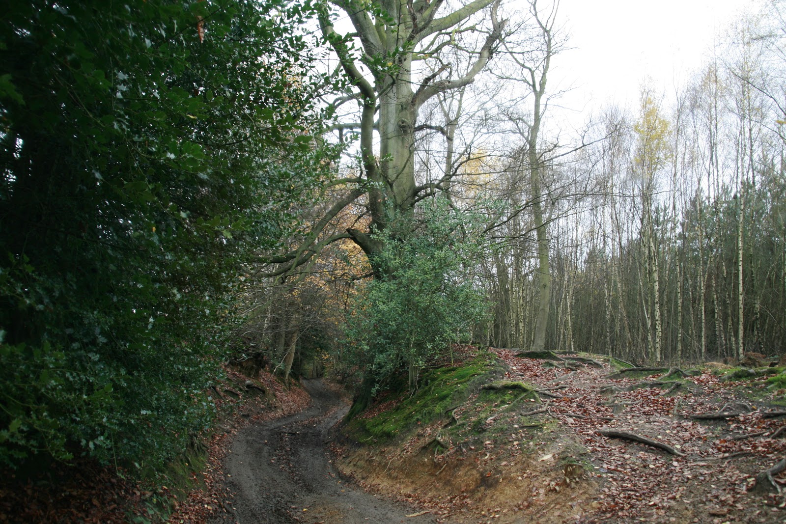
Where it begins, at it's junction with Sheephouse Lane just south of Wotton, the green lane heads north-east on a farm track hedged with hazel for around 200m, before it turns sharply south-east and continues through Abinger Forest. This northern end of the byway (at least on 09/08/2015) is quite overgrown with holly and one's paintwork will protest to the maximum, although encroachment is not a problem for the rest of the time. Further, a fallen beech tree means that vehicles with a roof rack or suspension lift will find it hard going to negotiate a path underneath it. Do take care or bring a chainsaw if you have one! Unfortunately there is evidence of some mouth-breathing scum leaving the byway and undertaking a spot of illegal off-roading around this northern end. We tire of saying this now: DON'T DO IT!!!
As the green lane winds it's way along the border of Sylvanus Wood (side note: Sylvanus was the Roman god of woods and fields) on it's eastern side and the Tilling Bourne in the valley to it's west, it's covered by a decent layer of mud, no doubt exacerbated by the wet weather we'd been suffering in November. Care should be taken to ensure that the surfqce of this byway does not become too rutted and damaged. It's not by any means bad enough to get stuck in, but if it gets any worse I'd recommend a voluntary seasonal TRO and the avoidance of driving this lane until thebdry weather comes around again.
The byway is also pretty uneven in places, which makes one's car take some quite impressive angles to the horizontal, however (although I cannot talk for any other brand of car) our Defender took it well in it's stride.
This byway is known to Surrey County Council as Wootton 526.
Statistics:
Total Distance: 5.43 km (3.4 mi)
Total Distance: 5.43 km (3.4 mi)
Total Time: 24:49
Moving Time: 22:08
Average Speed: 13.11 km/h (8.1 mi/h)
Average Moving Speed: 14.71 km/h (9.1 mi/h)
Min Elevation: 168 m (552 ft)
Max Elevation: 278 m (914 ft)
Elevation Gain: 148 m (487 ft)
Max Grade: 27 %
Min Grade: -10 %
9 comments:
Driven 9 August 2015, just a few points. First of all its very popular with Push Bikes, when you are trying to read the terrain and look ahead its easy to forget there may be cyclists trying to get past you who want to go much faster, keep checking you mirrors! Further to that, the vegetation in the North end is quite encroaching, best to fold mirrors away, especially as Holly is plentiful. There is one very annoying part on the North end were a low Beech tree makes roof rack equipped 4x4s life's a bit more difficult, just go slow! Some illegal off roading in the North end, don't! Its destroyed loads of the surrounding woodland.
Wow, thatnks so much for all this information Robert! Sterling work. Did you visit on a weekend perchance as we didn't see a soul when we drove it mid-week! I shall update this post with your findings.
And I shall also report the illegal off-roading to the council. Do you gave any more information or, better still, pictures and an exact location?
Not at all, happy to help, to be quite honest I would probably contact the woodland trust as its their land that the R.O.W goes through, I saw that they have put tree trunks across some parts but many have been rolled away, hmmm, odd!
Consider it done! You've been invaluable. If you visit any more byways in this area please do feel free to comment below the relevant post with any findings you may have that are not reflected on this site. To be frank, with over 350 green lanes to monitor we need all the help we can get!
Driven 25 March 2016, Severe washout developing at the Northern end. Sand has subsided and now means you have to tip toe around the edge, given the rain in the forecast I can only imagine it will get worse. Some delightful chaps have (given the size of the tyre tread) made this much worse by driving through it. The rate at which its becoming a severe obstacle (with guaranteed body damage) is very quick, over the course of less than week its tripled in size.
I can only imagine a TRO will now be applied to Wolvens lane, but we will have to see...
Thanks for the 'anonymous tip off', sir! We shall update this post with your findings.
According to Surrey C.C, remedial work has taken place with regard to the huge rut and is now open again!
Good lord! No TRO applied! I can't believe it, but so be it. Good on Surrey CC!
Post a Comment
Please keep it clean!
Note: only a member of this blog may post a comment.