- Overall Rating: 4
- Location: Weavers Down, Hampshire.
- OS Explorer Map 133, 'Haslemere & Petersfield'.
- Starting OS Grid Reference: SU836305
- Starting GPS Co-ordinates: N51 06' 80" W000 80' 70"
- Finishing OS Grid Reference: SU844306
- Finishing GPS Co-ordinates: N51 08' 00" W000 76' 60"
- To see: Hollycombe Steam Collection.
- ALWAYS follow the Greenlane Code!
 |
| Go left here. |
 |
| Go left here too! |
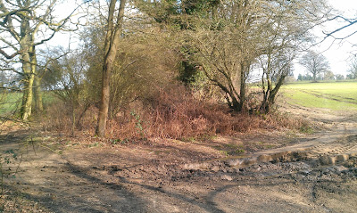
The green lane starts then uphill on a comparatively degraded, rutted muddy surface and the going gets a little harder and more technical. This is made harder by the fact that some huge trees have fallen over the track, and although they have been sawn clear there are still mighty stumps
that narrow the lane sufficiently to create a decent narrow obstacle, especially since in places the holly is closing in. Take care, and expect the odd scratch on the paintwork!
After climbing for a further 27m AMSL the gradient shallows out and the lane turns towards the north. Some bamboo from the back gardens that border the byway has gone absolutely mental here (it REALLY needs to be cleared, Mr. Homeowner) to the point where it stretches almost completely across the lane, but our Defender brushed past it with aplomb. The green lane then ends on Midhurst Road, just south of Liphook. Not a bad lane at all! Nearby to the south can be found the Hollycombe Steam Collection, a great day out if you have kids.
This is technically an unnamed byway so we christened it Quarry Lane, y'know, for the kicks. But according to Hampshire County Council this is Byway 44.
 |
| The 'pond', looking west. |
View Quarry Lane in a larger map
No comments:
Post a Comment
Please keep it clean!
Note: only a member of this blog may post a comment.